
Boorloo is the Nyoongar name for Perth, Western Australia. (The Nyoongar people are the traditional owners of the land in the south-west corner of Australia, who were here for around 60 000 years or so before the British colony was founded in 1829). So it is fitting that the new pedestrian/cycling bridge across the river, which opened today, is named after the city. I am of course pleased that public funds are being used for a pedestrian bridge, rather than further freeway extensions in this city, which is dominated by cars, so decided to attend the public opening ceremony today, despite the excessive heat.
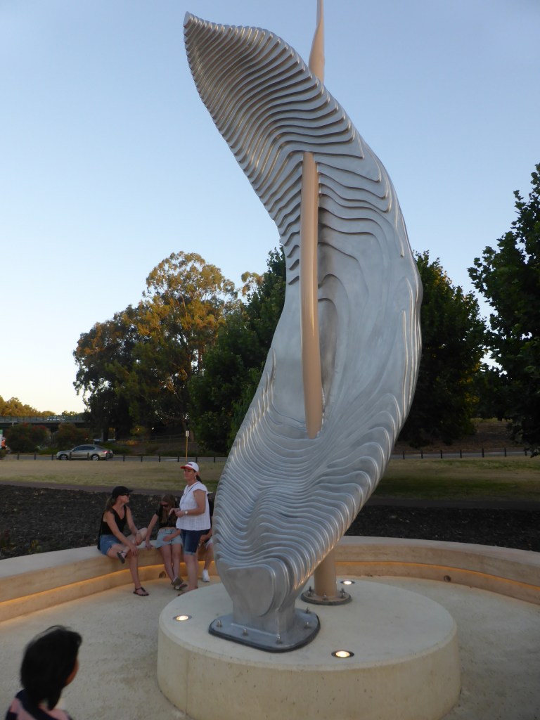
I arrived shortly before dark, to avoid the heat, and the first thing I saw was a sculpture depicting traditional objects – a digging stick (wanna) used by women and a booka (a cloak generally made of kangaroo skin). The first part of the bridge has very large versions of the wanna holding up cables, as you can see:

The bridge goes over what has always been called Heirisson Island as long as I can remember, although very few local people seem to know it was named after an obscure and otherwise insignificant Frenchman on a scientific mission up the Swan River around 1804 (well before the British arrived). A long time before that, in 1697, a Flemish explorer, Willem de Vlamingh, got as far up the Swan River as the islands, but no further. Little surprise that the area was known to the local Nyoongar people as Matagarup (which means ‘one leg deep’), which accounts for Vlamingh’s lack of progress I assume. [Probably a major reason for the British colonisation in 1829 was to make sure that they did so before the French, or even the Dutch.]
The island has had a chequered history, including recent Aboriginal protests, and most Perth people have never been on it. (I have been on it several times n recent years, however). A traffic Causeway across the island was critical for many years in the colony before the Narrows Bridge and the Freeway were built in 1959, finally providing a link between north and south of the river. Prior to the Freeway construction, southern suburbs like South Perth and Como (where I live) were hard to reach efficiently from the city and even regarded as a long way away by many people north of the river. The new bridge provides a link for pedestrians and cyclists, who rarely use the Causeway, and will allow people to easily, and pleasantly, walk or cycle around the entire Swan River area adjacent to the City.
I was pleased to see free drinking water stations available for the event, as most people these days carry a water bottle. The temperature had cooled down to about 37 C (from an earlier unpleasant maximum of 41 C) when I arrived around 7 pm.

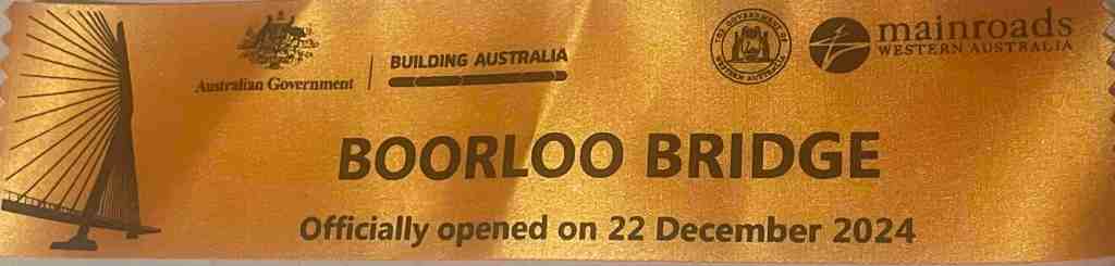
As well as a welcome drink of water, I picked up the commemorative banner of the occasion:
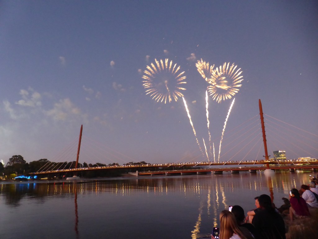
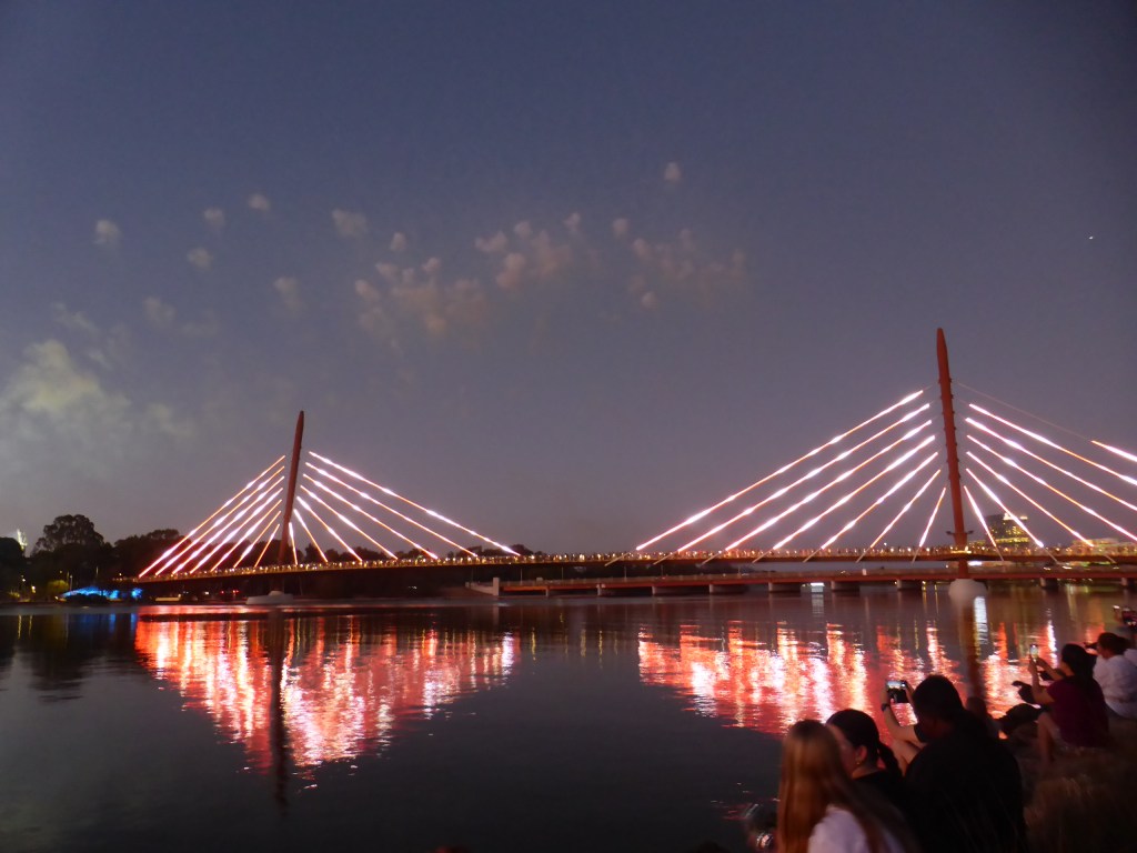
As the sun set, the bridge was opened with a fireworks display, appreciated by the crowd of picnickers assembled, including me. I’m not very good at photographing fireworks, but here is a sample of them to give a flavour of it. Clicking the mages will give you a better version, I think:


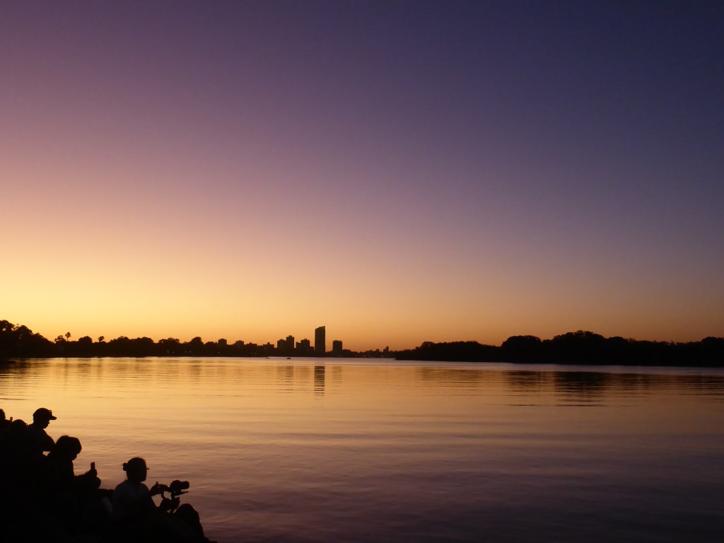
The fireworks distracted us a bit from the glorious sunset in the other direction: you can see the South Perth foreshore in the distance, with its new high-rise building sticking up. (The City of Perth is a bit right of this picture, and not shown here.) Beautiful colours … and expectant photographers waiting for the fireworks to start.
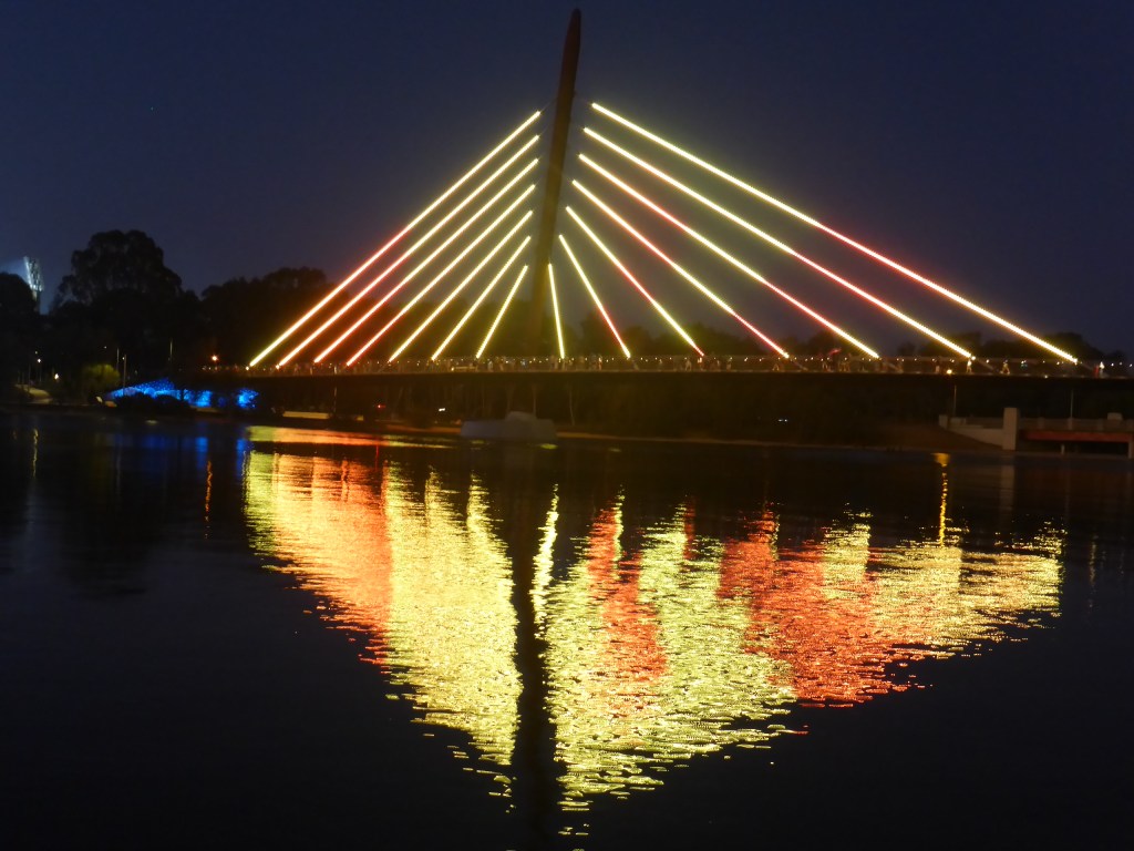
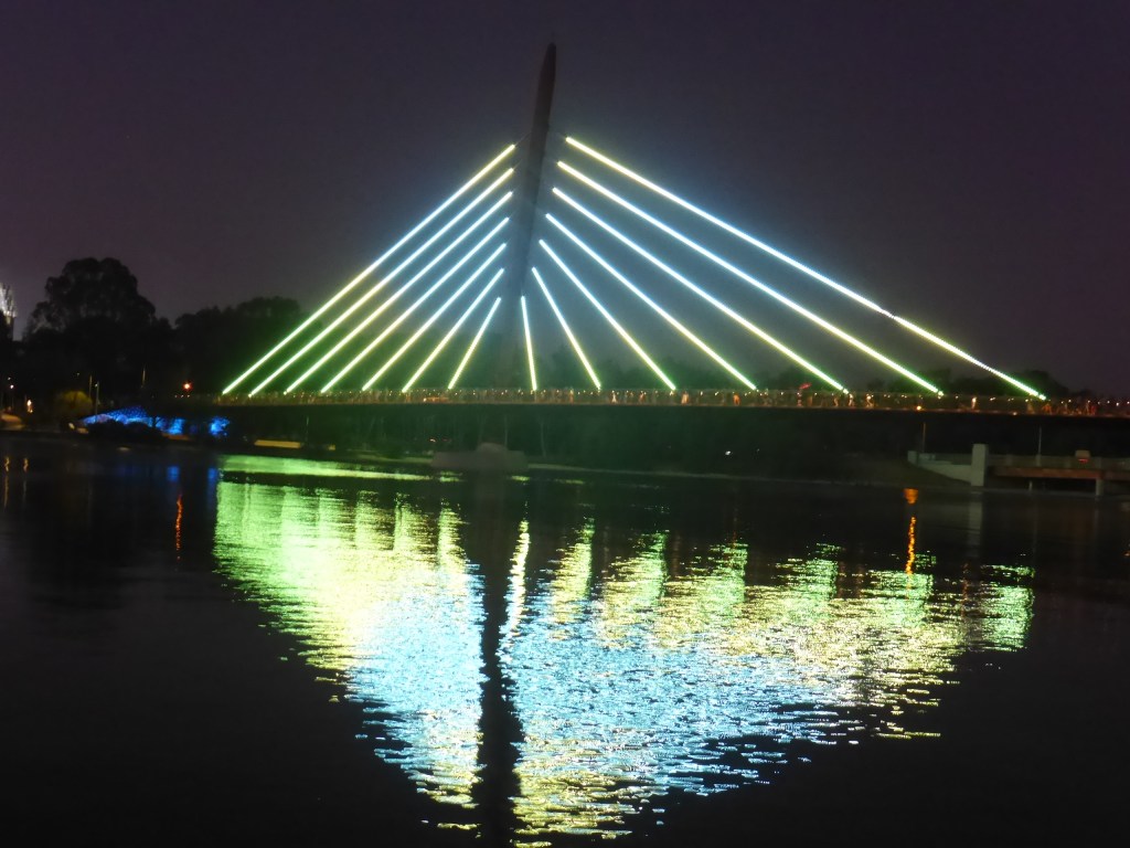
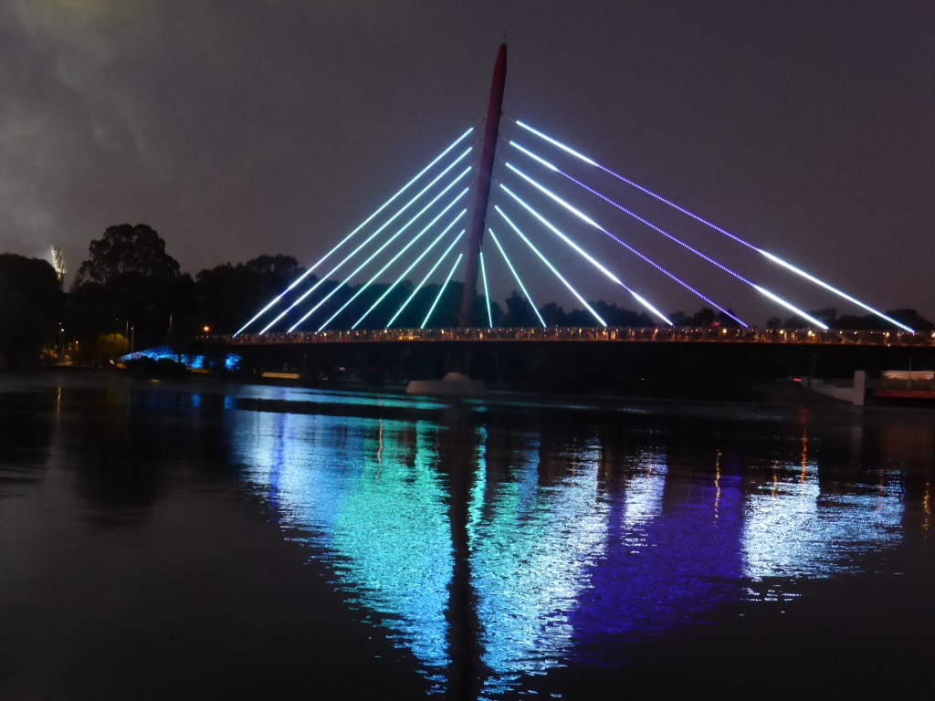
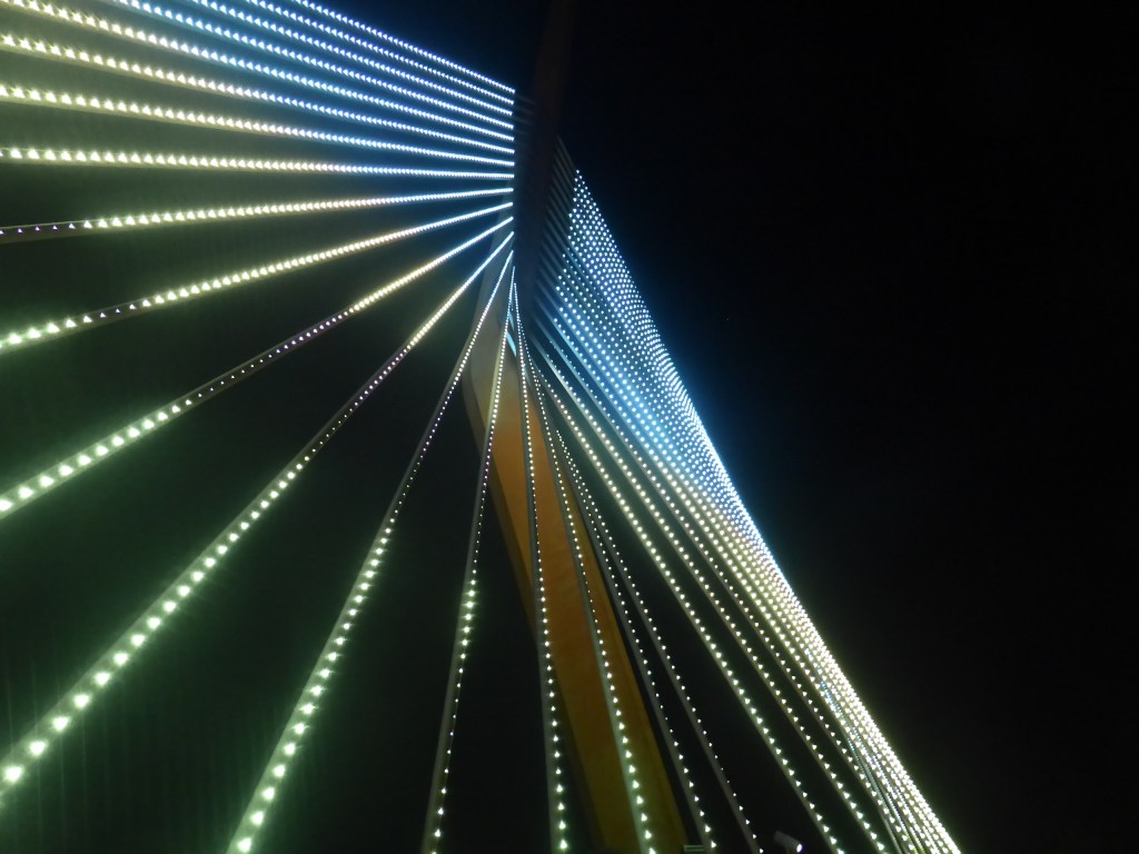
After the fireworks, we were treated to a lovely display of lighting on the various parts of the bridge. There are small LCD lights in the cables, which can be programmed in various ways to create lovely effects. (We are accustomed to this sort of thing with the Matagarup Bridge linking the Perth Stadium to the other side of the river.) Here is a sample of the lovely effects:
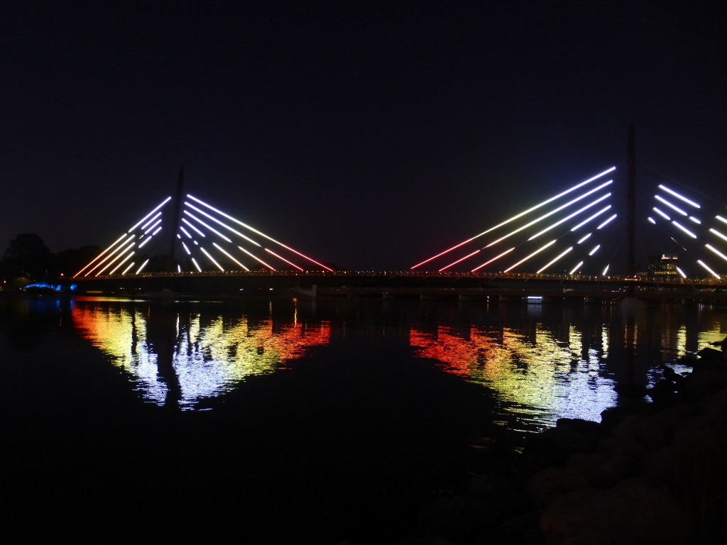
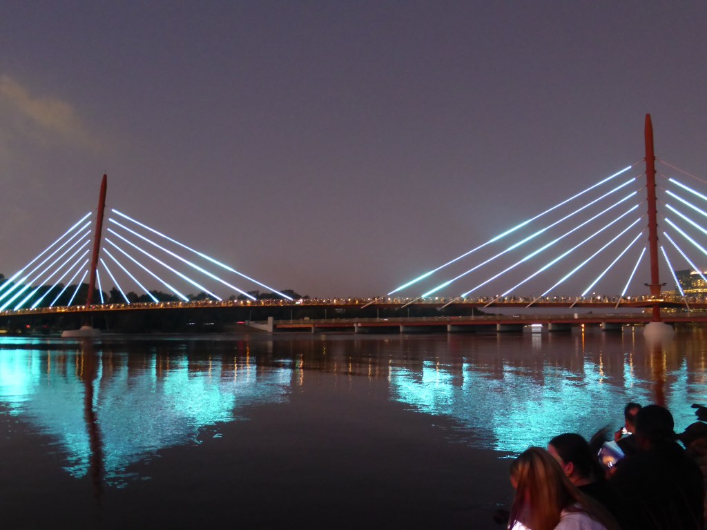
Here are a few more examples of just one part of the bridge, like the one shown at the top of this post, showing how the lighting system can create some lovely effects, helped along by their reflections of course.

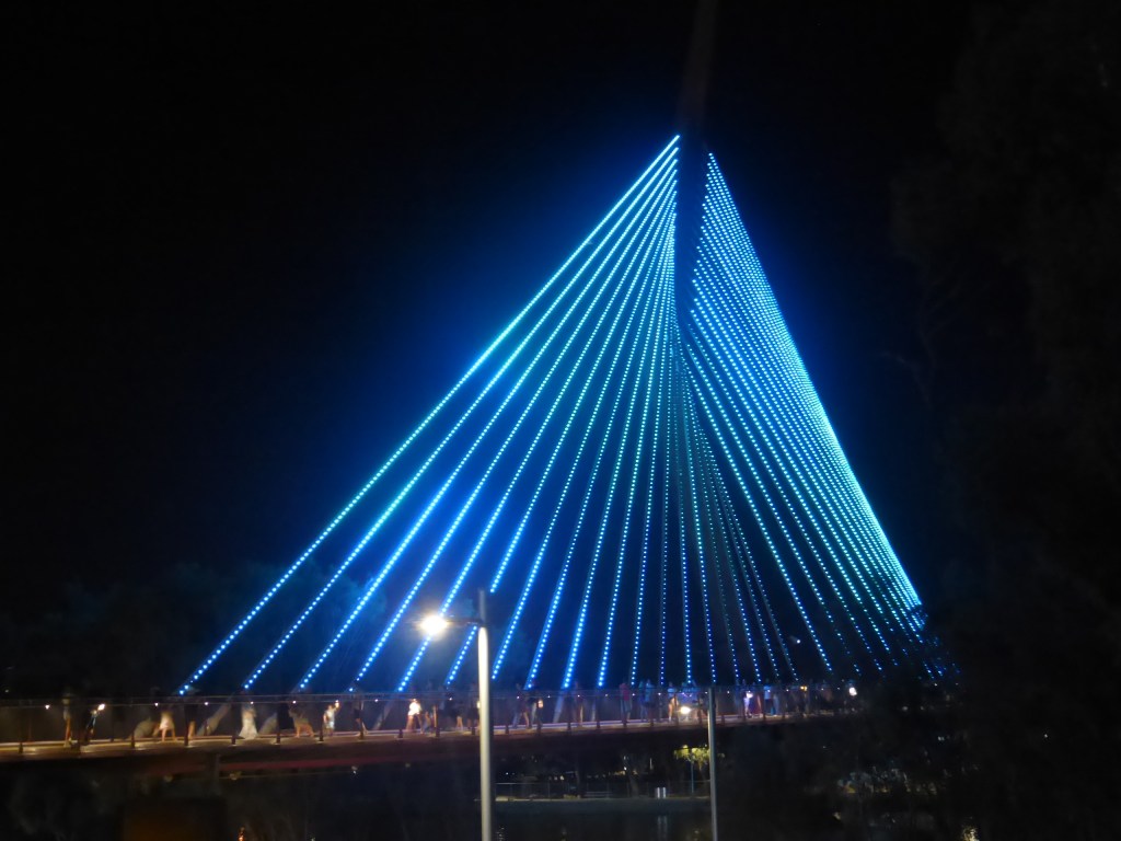
I walked across the bridge, of course, along with others, and enjoyed doing so as well as seeing the second part of the bridge, linking Heirisson Island to the north bank of the river. Where the first part of the bridge has two vertical struts, the second has only one, in the shape of a boomerang (not very clearly photographed here, I’m afraid, although much clearer in daylight). Also not clear is the way in which there are some native animals (such as kangaroos, fish, reptiles, … ) depicted as moving shadows in the lights. If you’re ever in Perth, check these out for yourself, as they exceed my photographic capabilities to show well.
There were various other artistic works associated with the bridge, and several plaques helping people interpret these as well as to learn a few words of the Nyoongar language. The traditional owners have of course been carefully consulted throughout the project and I hope that these will help with ongoing efforts to increase recognition of (all) of our heritage. Here are some examples:


Despite the heat, I was pleased that I was there at this historic time. I’m sure that I will make good use of the Boorlo Bridge, as will others, and am pleased that it is finally finished. I have walked right around the river (called Perth Water locally, or Derbal Yerrigan to Nyoongar people) several times, and have never enjoyed the Causeway bit; that has now been fixed. Of course, it is expected that cyclists will also use the bridge to get to work in the city or for leisure (as they already do at the other end, via the Narrows Bridge), so I think the bridge is a good investment of government funds, both state and federal. Hopefully, it will help to encourage people to get out of their cars a bit more and enjoy their beautiful city a bit more.
Finally, the picture below on the bridge deck says welcome (Kaya) to Perth (Boorloo) and also shows our native symbol of a black swan (ironically shown here in white light!).

Welcome to Boorloo Bridge!
